| Current Surface Analysis | |||
 Surface TWC |

Satellite & Surface Unisys |
 Surface Analysis Intellicast |
 Surface Analysis w Radar & IR Sat - Intellicast |

Surface Winds with Radar Unisys |
Current Surface Winds TWC |
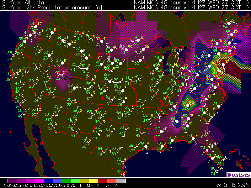 Precipitation - Last 12 hours Unisys |
Airport Overview TWC |
| Current Satellite | |||

Satellite Radar Plot Unisys |
National Infrared Intellicast |
National Infrared TWC |

National Infrared NOAA |
| Current Radar | |||
Current Radar w Cloud Tops NOAA |

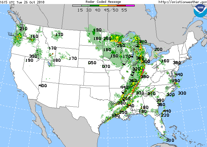
Current Radar Unisys |

Current Radar Intellicast |

Current Radar TWC |
| Winds Aloft & Upper Air | |||
|
Winds Aloft - 10,000 ft TWC |
Winds Aloft - 18,000 ft TWC |
Winds Aloft - 34,000 ft TWC |
Jetstream TWC |

Jetstream Intellicast |

Winds aloft - 34,000 ft tomorrow TWC |

Winds aloft - 34,000 ft day after tomorrow TWC |
 Cloud tops & cell movement Intellicast |
| Forecast | |||

12 hr Surface Forecast Intellicast |
Morning Forecast TWC |
Midday Forecast TWC |
Evening ForecastTWC |
|
Tomorrow Evening Forecast TWC |
 Precipitation Forecast TWC |
Surface Winds - Tomorrow TWC |

Convective Outlook NOAA |
| Potential Areas of Concern | |||
|
Air Turbulence Potential TWC |
Aircraft Icing Potential TWC |
IFR/Mountain Obscuration Potential TWC |
|


Send email to: Ask@RPS3.Com
Designed and Maintained by RPS
©2015 All Rights Reserved